
Meanders
A meander is a winding curve or bend in a river. Meanders are the result of both erosional and depositional processes. They are typical of the middle and lower course of a river. This is because vertical erosion is replaced by a sideways form of erosion called LATERAL erosion, plus deposition within the floodplain.
The image below shows a series of meanders. Notice the deposition on the inside of the meanders (pale material) and the river cliffs or bluffs (indicated by dark shadows) on the outside of the meanders.
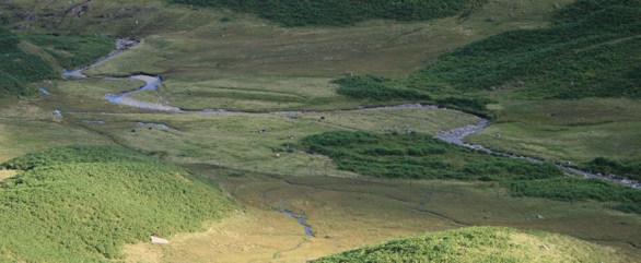
A series of meanders
Again, the image below shows a series of meanders. The river shown in the photograph is swollen due to recent rainfall. Once again we can see deposition on the inside curves of the meander.
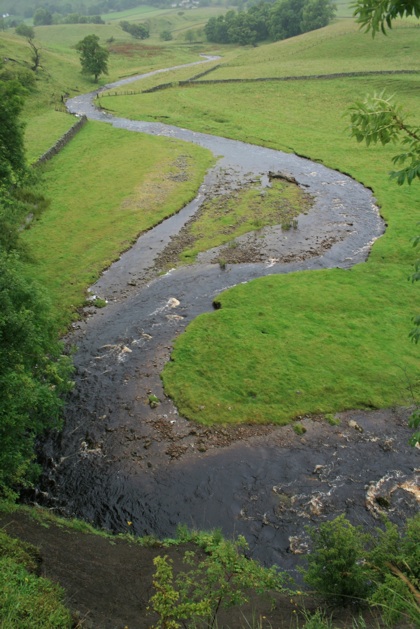
A swollen river
Erosion, transportation and deposition are all processes that create the characteristic features of meanders shown in the images above.
The videos below shows meander initiation and braiding in a small river model.
There are several stages involved in the creation of meanders. These are discussed below.
Stage 1
In low flow conditions straight river channels have bars of sediment on their beds. Flowing water weavers around these bars of sediment. This creates deeper pathways where most of the water flows called pools and shallow areas where less water flows called riffles. This causes the river flow to swing from side to side.
The map below shows bars of sediment exposed due to the low level of water in the channel. Notice how the flow of water weaves around the sediment bars.
Stage 2
Where the river swings towards the bank erosion causes undercutting. On the opposite side of the channel where the velocity is lower material is deposited. Therefore the river does not get any wider. The image below shows evidence of undercutting on the outer bank and deposition on the inner bank of the meander.
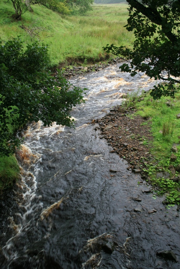
Stage 3 in the formation of a meander
Stage 3
Continued erosion along the outer bank, as the result of hydraulic action and abrasion, creates a river cliff or bluff. A point bar forms on the inner bank. This is a gently sloping deposit of sand, gravel and pebbles. The image below shows a point bar.
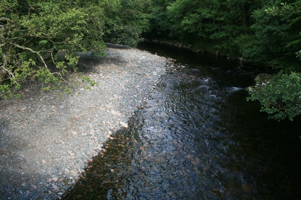
Point bar
Stage 4
Meanders are perpetuated through a process called helicoidal flow. As the surface flow of water hits the outer bank it corkscrews, flows along the river bed then deposits eroded material on the inner bank.
Step 5
Erosion is greatest beyond the middle of the bend in the meander. This causes the meander to migrate downstream over time. By looking at aerial photographs it is possible to see former channels on the floodplain.
Today’s most popular pages
Support
While you are here, please consider supporting A Level Geography.
If you have found this site useful please support us keeping A Level Geography free by making a small, secure donation via Paypal towards to the running costs of the site.
Many thanks,
Anthony
Drainage basin hydrological cycle
Find out about the characteristics of the drainage basing hydrological cycle.
Storm Hydrograph
Hydrographs can be used to illustrate discharge. These can be used to show annual discharge patters of flow in relation to climate.
The long profile of a river
The long profile of a river shows changes in the height (altitude) of the course of a river from its source to its mouth.
Water Balance
The balance between inputs and outputs is known as the water balance or budget. The water…
Erosion, transportation and deposition
There are three main types of processes that occur in a river. These are erosion, transportation and deposition.
Changing channel characteristics
The characteristics of a river channel change along its long profile. Changes occur in the cross profile, wetted…
You must be logged in to post a comment.